Southern Minnesota’s first sign of spring? Flooding! NWS issues Flood Watch

(Mankato, MN) – Mother Nature suddenly flipped the switch on spring, and she’s turning it on it dramatic fashion.
After record-setting February snowfall and record low temperatures to start March, it appears southern Minnesota’s first sign of spring could be flooding
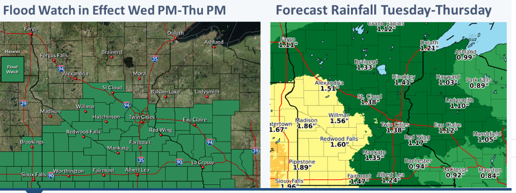
A Flood Watch has been issued by the National Weather Service for Blue Earth, Brown, Nicollet, Watonwan, Waseca, and the surrounding counties. The watch goes into effect at 10 a.m. Wednesday for the Mankato area, and expires at 7 p.m. Thursday.
Forecasters say that the area could receive up to 1.35 inches of rain, with an inch of accumulating snowfall possible on Thursday. Wednesday night even carries the threat of thunderstorms, which could mean increased rainfall for the region.
According to NWS, a Flood Watch means that snowmelt and rainfall could potentially cause flooding. Local forecasters say the flooding potential is a concern in streets, moreso than bodies of water. The frozen ground won’t be able to absorb the snowmelt and rainfall, so MnDOT and crews in communities across the region have been working to clear drainage spots of snow and ice.
The sun will make an appearance on Friday, but plan for blustery northwest winds to take the joy out of its warmth. The weekend will rebound nicely, however. Sunshine looks plentiful for Sunday and Monday, with highs in the high 30’s.
Click here to LIKE Southern Minnesota News on Facebook.
Click here to FOLLOW @SouthernMNnews on Twitter.
(Copyright © 2019 Southern Minnesota News – Alpha Media Mankato. All rights reserved.)